 |
|
DRD SCIENCEReportsDRD Report for the Big Gypsum Monitoring Site project, funded by the Colorado Water Conservation Board: Baseline Field Investigations, Science-Based Opportunities and Potential Tools for Improvement of the Downstream Environment on the Lower Dolores River (Note: Version II will be released this fall once all field work is completed) DRD Big Gypsum Monitoring Site Grant Report, Edition II, 2011
2007 Final Report to the CWBC (PDF, 19 KB) Executive Summary: DRD Core Science Team Report - May 2005The Dolores River Dialogue (“DRD or Dialogue”) is a multi-stakeholder effort aimed at the environment of the Dolores River downstream of McPhee Dam. The dialogue is considering a range of creative alternatives. The practical actions that may result from this effort fall into three categories:
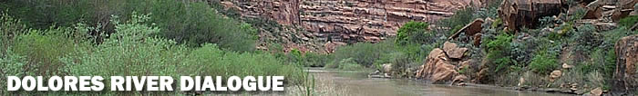
To evaluate the various strategies and determine the preferred alternatives, the Dialogue has convened a Core Science Team with technical expertise in several disciplines. This team, was established in early February of this 2005 to study and ultimately integrate four primary areas of investigation; Native warm water fisheries, Cold water fisheries, Geomorphology and Riparian Ecology with hydrology through a community based stewardship approach. The report presents the results of the CST’s initial investigations into conditions in the Dolores River. These evaluations include review of literature and previously prepared documents related to the Dolores River, discussion of linkages between flow and ecological and physical processes in the Dolores River and identification of key data gaps. The information presented here provides a basis for future recommendations regarding flow management, channel work, and/or other management options. Study AreaThe Dolores River flows from its headwaters in the San Juan Mountains to the confluence of the Colorado River in Utah. The study area consists of the Dolores River from McPhee Dam downstream to the confluence of the Colorado River, a length of approximately 200 river miles. The river courses through a range of natural communities and provides water for a number of municipal, industrial and agricultural uses. In order to provide a framework for analysis of conditions along the lower Dolores River and illuminate potential future management opportunities, Geographical Information Systems (GIS) were used to help define 8 reaches. These reaches were identified by differences in gradient, sinuosity, chemical parameters (e.g. salts) vegetative characteristics and potential limiting factors to natural stream channel movement and formation. In order to manage the science tasks, the river has been broken into two main focal areas. McPhee Dam downstream to Slickrock bridge and Slickrock Bridge to the confluence with the Colorado river.
CORE SCIENCE INDIVIUAL DISCIPLINE SUMMARIESGeomorphologyThe main conclusion of the Geomorphology report is that flows are the limiting factor to physical and ecological processes, and flow management is the key issue in terms of maintaining or restoring these processes. Flow is not only the single most important driving factor, it is also the driving factor that management has the greatest ability to influence. The analysis suggests that reductions in high flows below McPhee Dam are a primary cause of geomorphic changes in the Dolores River downstream of the dam. The primary changes that have occurred due to flow modification have likely included, changes in channel dimensions, including narrowing and reduced depth, growth of lateral and mid-channel bars associated with reduced sediment mobility and encroachment of riparian vegetation. Other changes may be changes in the size, embeddedness, and mobility of bed sediments, simplification of bed morphology and reduced channel-floodplain connectivity. Warm Water FisheryThere are currently few rivers in the Colorado that have high biomass populations of the native fish species roundtail chub, flannelmouth sucker and bluehead sucker. Declining populations of roundtail chub and flannelmouth sucker have been documented for both state-wide and basin-wide scales in recent years. The CDOW currently has fish monitoring sites established on the Dolores River which indicate roundtail chub and flannelmouth sucker had a secure population in the Dolores River until recently. Habitat protection for roundtail chub in the Dolores River has become a priority issue for state fisheries managers and needs to be implemented quickly in order to avoid further population declines. Presumably the Dolores River genetic strain of roundtail chub, flannelmouth sucker, and bluehead sucker is better fit to persist in upper Dolores River, since they were able to persist given historic (gage records) flow conditions. Maintenance of a viable native fish community in the Dolores River potentially helps avoid additional native species in being listed for federal protection. Cold Water FisheryReach 1, at least from McPhee Dam to Bradfield Bridge, was intensively evaluated in the late 1980’s and early 1990’s pertaining to cold water fishery (trout) issues. Water Temperature may be an issue from Lone Dome to Bradfield Bridge. Habitat improvements would be beneficial and should be focused on enhancing physical habitats for juvenile and adult trout, not for spawning or rearing habitats. Early survey work conducted this year indicated a poor production of Rainbow Trout in Reach 1 and good production of Brown Trout in portions of Reach 2. Riparian EcologyMost changes in community structure do not result from a singe event or single stressor but from multiple of interacting causes within a particular riparian corridor. Riparian vegetation plays a key role in the human-valued services provided by rivers and also provides the fundamental structure for diversity of flora and fauna found along the river. A variety of factors influence the structure and composition of riparian vegetation growing along a particular reach of river, such as flows, salinity and soil type. Along the lower Dolores River study area a variety of habitats exist. These habitats range form a dominant Narrow leaf Cottonwood community in reach 1, Ponderosa dominant in reach 2, Juniper and Pinion in reach 3 and Tamarisk dominant from reaches 4-8. Willows are abundant throughout many of the reaches. However, Cottonwood’s are not the dominant woody plant specie along the lower portion of the Dolores River and are found mainly in isolated patches with some of these patches demonstrating good age class distribution. Regulated flow of the Dolores River has greatly reduced volume discharge in reach 4 and may be one reason for the decline in Cottonwood regeneration. The solution to riparian habitat improvement may be found through the cooperative efforts of landowners, land managers, and ecologists. TamariskTamarisk is the dominant woody plant specie in many areas along the lower portion of the study area. Perennial flows and increases in salinity may be a contributing factor. Tamarisk may be having an influence on channel morphology by creating physical parmeters that during times of low flows increase sediment deposition within in the channel. Tamarisk may also be limiting the normal recruitment and regeneration of native cottonwoods along the lower portion of the study area. Eradication of Tamarisk in “Key’ areas may provide an opportunity for warm water fisheries habitat improvement. SummaryThe process of building a multi-disciplined report for the Dolores River Dialogue has provided an opportunity to bring new issues to the table concerning the science of the lower Dolores River. Although the Geomorphology report is adamant that flow is the number one reason for changes in the ecology of the river, other factors are also contributors to the process. McPhee Dam is now a part of the ecology of the river and therefore, looking for opportunities to enhance the ecology of the river with a combination of alternatives will likely result in greater success for all interested parties.
|
|