 |
|
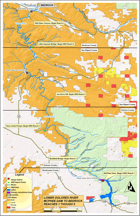
GENERAL STUDY AREA MAP
This DRD map depicts the area from below McPhee Dam to Bedrock, which is the main area the DRD focuses on. A full DRD map of the entire length of the Dolores River in Colorado is available (to the State line by Grand Junction) by emailing the facilitator ( mporternorton@gmail.com)
|
|